
Hill resort design mistakes often begin when a fixed room target is imposed before the land is properly understood
Hill resort design mistakes rarely begin with poor architectural style. They usually begin when a sloping property is treated like an empty, level construction site.
A hill already has its own working system. It contains natural drainage routes, soil layers, rock formations, vegetation, wind exposure, and established patterns of water movement.
Every road, platform, building, and retaining structure changes that system.
Ignoring the natural landscape, drainage patterns, soil conditions, slope stability, and local climate can result in the following:
- Unstable cut areas
- Water collection near foundations
- Expensive retaining structures
- Difficult vehicle access
- Recurring maintenance problems
- Long staff and service routes
- Environmental damage
- Uncomfortable guest spaces
The first question should not be
How many rooms can be placed on this property?
A better question is
How many rooms can this property support without excessive disturbance?
That shift affects the location of guest villas, restaurants, pools, parking areas, service yards, roads, and walking paths.
A well-planned hill resort does not simply look connected to nature. Its buildings, circulation, drainage, and daily operations must work with the terrain.
Professional review advised. Every hill project requires site-specific input from qualified geological, geotechnical, structural, civil, fire-safety, and environmental professionals.
Unpopular truth: A resort can look environmentally sensitive in a presentation while depending on extensive hidden excavation, concrete, and retaining work.
What Is Terrain Debt in Hill Resort Design?
Terrain debt increases when each additional room requires disproportionate excavation, roads, retaining structures or daily uphill movement.
Terrain debt is the long-term burden created when a resort design requires more physical intervention than the site can comfortably support.
It is not an official engineering term. It is a planning idea that helps owners compare the hidden consequences of different resort concepts.
Terrain debt has five main parts.
Ground debt
Ground debt includes the soil and rock that must be removed, filled, restrained, or stabilized.
A large level platform may simplify the building plan. However, it may also require deep uphill cutting and a tall retaining structure on the lower side.
Water debt
Water debt includes the drains, channels, outlets, silt traps, and inspection points required after natural water paths have been altered.
The more a project changes existing drainage, the more constructed drainage it may need.
Access debt
Access debt includes new roads, bends, turning areas, parking platforms, edge protection, and emergency routes.
On some hill properties, the access system may disturb more land than the guest buildings.
Utility debt
Utility debt includes water supply, wastewater, electrical, and communication lines spread across different levels.
A widely scattered resort may require longer pipes, cables, pumps, and service chambers.
Operating debt
Operating debt is the repeated effort required to move guests, luggage, food, linen, waste, and maintenance teams around the resort.
A distant villa may feel private to a guest while requiring several uphill journeys from employees.
Terrain Disturbance Ledger
Use this table to compare the most important physical and operational effects of each concept.
Item | Unit | Project Input | Review Stage | Decision |
Excavation and filling | cubic metres (m³) | Consultant data | Concept design | Compare options |
Retaining structures | linear metres (m) | Consultant data | Concept design | Reduce where possible |
Roads and access | linear metres (m) | Design data | Concept design | Test essential routes |
Guest and staff movement | distance + vertical rise (m) | Operations data | Before layout freeze | Review daily effort |
Actual measurements should come from the project consultants. Values should not be guessed simply to justify a preferred layout.
Trade-off: Measuring terrain debt adds work during concept design, but it reveals hidden construction and operating demands before the plan is approved.
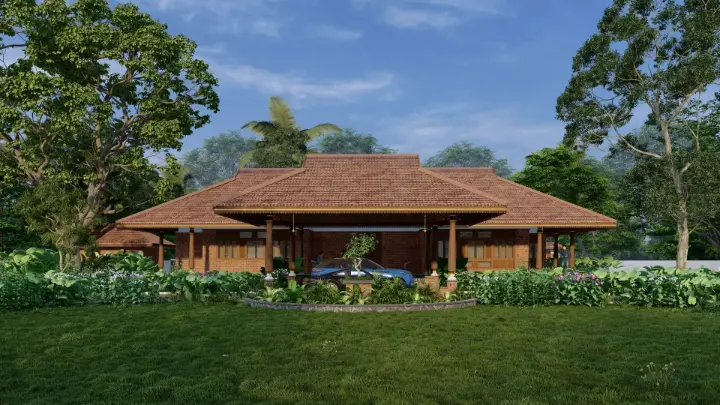
Nine Hill Resort Design Mistakes to Avoid
The most serious hill resort mistakes create several connected problems rather than one isolated technical defect.
1. Fixing the room count before setting disturbance limits
A resort brief often begins with a fixed number of villas, suites, or cottages.
The design team is then asked to fit that program onto the land, even when some locations require major cutting, long roads, or several retaining structures.
This reverses the safer planning sequence.
The fact that a room fits on a drawing does not mean that its location is practical, safe, or economical.
A better approach
Set a preliminary disturbance budget alongside the commercial brief.
It should identify:
- Areas that should remain unbuilt
- Acceptable excavation limits
- Vegetation-retention priorities
- Natural water routes that should remain open
- Maximum practical road expansion
- Acceptable guest and service travel distances
The final room count should respond to these limits.
The decision question
How many rooms can the property support without requiring disproportionate disturbance?
Unpopular truth: A smaller resort with well-positioned rooms may perform better than a larger property burdened by difficult access and high maintenance.
2. Treating contour lines as background information
Contours are often visible in the survey but have little influence on the first architectural plan.
Buildings are positioned according to views, symmetry, or room relationships. The civil team is then expected to adjust the land around them.
This may create deep cuts, large filled platforms, and tall valley-side edges.
A better approach
Prepare the first massing study directly over the contour and drainage drawings.
Test options such as the following:
- Buildings positioned along contours
- Split-level floor plans
- Smaller stepped clusters
- Bridges between suitable platforms
- Shorter building footprints
- Areas left undeveloped
The contour test
Remove the proposed finished platform lines from the plan and look only at the natural contours.
When the design becomes impossible without major reshaping, the concept is probably working against the property.
Trade-off: A contour-responsive layout may be less symmetrical, but it can reduce excavation and create more varied guest experiences.
3. Designing drainage after fixing the buildings and roads
Drainage is often added after the main resort plan has been approved.
This treats rainwater as a pipe-sizing issue rather than a property-wide planning concern.
Water may enter from land above the resort, cross a road, move behind a retaining structure, and continue toward a lower property. Blocking one part of this route may simply move the problem elsewhere.
A better approach: Water Path Proof
Every source of water should have a continuous route shown on one coordinated drawing.
The drawing should identify:
- Water entering from the upper property boundary
- Existing streams and shallow channels
- Roof-water discharge
- Road runoff
- Pool overflow
- Landscape runoff
- Drainage behind retaining structures
- Emergency overflow paths
- Final discharge points
- Cleaning and inspection access
The water-path question
Point to any roof, road, or uphill catchment and ask:
Where does this water go during heavy rain, and how can that route be inspected?
An uncertain answer means the drainage plan is incomplete.
Local detail: Leaves, soil, and construction debris carried during Kerala’s rainy season may block a drain that appeared adequate during a dry inspection.
4. Assuming one ground condition across the property
A large hill property may contain shallow rock, deep soil, filled ground, seepage zones, and previously disturbed areas.
However, early planning sometimes treats one investigation point as representative of the entire site.
The same foundation assumption may then be applied to villas, roads, pools, restaurants, and service buildings located far apart.
A better approach
Divide the property into ground-condition zones.
The investigation plan should respond to:
- Proposed building platforms
- Road cuts
- Retaining-wall locations
- Pools and water tanks
- Visible rock
- Seepage areas
- Existing cracks
- Major elevation changes
The architect, structural engineer, and geotechnical consultant should review these zones together.
The foundation question
What evidence confirms the ground condition below this exact building location?
A general statement about the soil across the property is not enough.
Trade-off: Additional investigation increases early consultancy costs, but it reduces unsuitable assumptions and expensive construction changes.
5. Planning roads after placing the buildings
Roads are sometimes treated as the leftover space between buildings.
This can create steep sections, sharp bends, large cut faces, and dead ends where service or emergency vehicles cannot turn.
Access planning must consider more than guest cars.
The design should test the following:
- Fire and emergency vehicles
- Supply vehicles
- Waste collection
- Staff transport
- Guest luggage movement
- Laundry movement
- Food delivery
- Maintenance access
- Construction equipment
A better approach: Vehicle Role Review
For every essential vehicle, record:
- Required destination
- Frequency of use
- Turning requirement
- Waiting space
- Loading and unloading point
- Wet-weather access needs
- Conflict with guest movement
The access question
Can the largest essential vehicle complete its route without reversing through a guest area?
Trade-off: Direct vehicle access to every room improves convenience but increases road area, runoff, noise, and maintenance.
6. Treating retaining walls as ordinary drawing elements
A retaining wall may appear as a simple line in the architectural plan.
In reality, it represents a major structural, drainage and maintenance commitment.
Each wall must be coordinated with:
- Soil and rock conditions
- Groundwater
- Foundations
- Loads from roads and buildings
- Backfill material
- Drainage outlets
- Inspection access
- Construction sequence
A better approach: Wall-and-Water Pairing
Every retaining structure should be connected to:
- A structural design reference
- A drainage route
- An inspection route
- A responsible maintenance team
The maintenance question
Can the full wall and its drainage outlets be inspected after the resort opens?
Unpopular truth: Dense planting may hide a retaining wall from guests while also hiding early signs of blocked drainage or movement.
7. Selecting pools and glass walls only for the view
Infinity pools and large glazed rooms are common in resort concepts because they create strong promotional images.
They can also occupy the most exposed part of the property.
Pools introduce:
- Concentrated structural loads
- Waterproofing requirements
- Overflow water
- Leakage risk
- Difficult maintenance access
Large glass walls may increase:
- Glare
- Solar heat
- Cooling demand
- Exposure to wind-driven rain
- Cleaning and replacement costs
A better approach: View–Comfort–Consequence Review
Before approving a view-focused feature, ask:
- View: What experience will it create?
- Comfort: How will it perform through different times and seasons?
- Consequence: What happens if the water, waterproofing or access system fails?
The design question
Is this the best location for the guest, or only the best location for the photograph?
Trade-off: A shaded, framed opening may offer a narrower view but provide better comfort for more hours of the day.
8. Creating privacy without measuring daily operations
Scattered villas can provide privacy and a close connection to the landscape.
The same layout can create long service routes.
Every remote villa still requires:
- Housekeeping
- Linen replacement
- Food delivery
- Waste removal
- Maintenance
- Emergency response
- Luggage movement
A better approach: Vertical Operations Map
Map the regular journeys of:
- A guest arriving with luggage
- A housekeeping employee
- A room-service employee
- A maintenance technician
- A waste-collection team
- An emergency responder
Measure horizontal distance and vertical rise separately.
A route that appears short on a flat plan may still involve a difficult climb.
The operations question
How many times must employees repeat this journey during a normal operating day?
Unpopular truth: Privacy created mainly through excessive distance is often paid for through additional staff, vehiclesvehicles, and service time.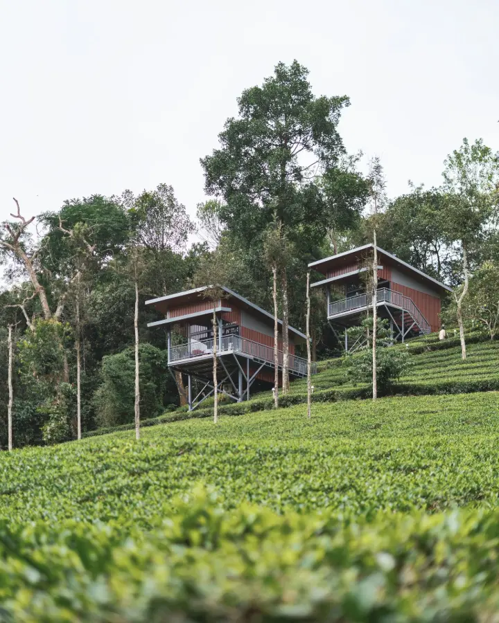
9. Adding landscape design after civil work
Landscape design is sometimes treated as the final layer used to make completed construction appear natural.
On a hill property, landscape planning should begin much earlier.
Existing vegetation, roots, ground cover, and shallow depressions may reveal important information about water and soil behavior.
A better approach
The landscape architect should participate while these decisions remain open:
- Building locations
- Road alignment
- Drainage routes
- Tree-retention zones
- Construction access
- Material-storage areas
- Excavated-material handling
- Slope restoration
- Long-term maintenance access
The landscape question
Which existing natural systems are already helping the property, and how will the design protect them?
Local detail: Dense vegetation may conceal springs, erosion channels, or older drainage paths. Tree mapping should therefore be combined with direct ground inspection.
Why Local Architectural Experience Matters
Local experience is valuable when it improves site questions, technical coordination, and construction decisions.
A hill resort requires close coordination between architecture, structural engineering, civil work, geotechnical advice, landscape planning, and resort operations.
A proposal that appears resolved on screen may become difficult to construct when the property has the following:
- Restricted road access
- Changing ground conditions
- Heavy seasonal rain
- Limited machinery access
- Limited material-storage areas
- Difficult service movement
Working with experienced architects in Perinthalmanna can help owners connect the design brief with Kerala’s climate, construction practices, and regional site conditions.
Local architectural experience can support decisions involving:
- Seasonal rainfall
- Building orientation
- Material durability
- Construction access
- Contractor coordination
- Drain maintenance
- Regional material availability
- Construction sequencing
- Site supervision
However, local experience does not replace geological investigation, geotechnical testing, structural design, or statutory approval.
Owners planning hospitality projects can also explore the firm’s hospitality architecture services, architecture services across Kerala, and selected architecture projects in Kerala.
Trade-off: Early coordination requires more effort before concept approval, but it can reveal access, material, and execution problems before construction begins.
Questions Resort Owners Should Ask Before Approving a Plan
A strong resort brief replaces broad design preferences with questions that require measurable evidence
What should happen before the first detailed plan?
The project team should complete or commission the following:
- Boundary verification
- Detailed topographical survey
- Initial hazard screening
- Drainage and catchment mapping
- Tree and vegetation recording
- Access-feasibility study
- Geological and geotechnical planning
- Preliminary approval review
- Identification of suitable development areas
Is a hazard map enough to approve the property?
A hazard or susceptibility map can support early screening. It cannot certify the safety of a particular property or building platform.
Site-specific geological and geotechnical investigations are still required.
How should two concept options be compared?
Compare more than room count and total built area.
Review the estimated excavation, retaining-wall requirements, road length, vegetation affected, utility routes, guest travel, staff movement, and the amount of land left undisturbed.
Should every room face the valley?
Not necessarily.
A valley view must be balanced with heat, glare, wind, privacy, access, room comfort, and emergency planning.
Forest, garden, and framed landscape views may create equally valuable guest experiences.
Are elevated buildings always better than cutting the slope?
No.
Elevated structures may reduce certain forms of ground disturbance, but they still require suitable foundations, access, utilities, fire planning, and maintenance space.
When should the resort operations team review the plan?
Before room locations and service routes are fixed.
The operations team should test check-in, luggage movement, housekeeping, room service, waste removal, maintenance, staff movement, and emergency response.
Which sustainability measures should come first?
Start with measures that avoid unnecessary physical and operating demands:
- Reduce excavation
- Protect water routes
- Retain useful vegetation
- Limit unnecessary roads
- Use climate-responsive orientation
- Shorten service routes
- Keep drainage and utilities accessible
Trade-off: A slower concept stage can reduce later redesign because important site questions are answered before detailed documentation begins.
Common Red Flags During Design Review
A hill resort design should be paused when its drawings hide disturbance instead of measuring it.
Watch for these warning signs:
- The room target is fixed, but disturbance limits are not.
- Buildings were located before the contour survey was reviewed.
- Finished levels are shown without existing ground levels.
- Earthwork quantities are missing from concept comparisons.
- One soil assumption is applied across widely separated structures.
- Retaining walls are shown without drainage or inspection access.
- Roof and road water meet at one uncontrolled outlet.
- A pool occupies a valley edge without a failure-consequence review.
- The service road is also the main guest walking route.
- Delivery or emergency vehicles cannot turn safely.
- Accessible movement depends entirely on internal vehicles.
- Landscape planning begins after roads and drains are fixed.
- Excavated material has no identified handling area.
- The drainage plan shows outlets but no cleaning access.
- A dry-season inspection is treated as proof of monsoon performance.
- Staff travel distances have never been measured.
Unpopular truth: The least expensive concept may only appear affordable because roads, drainage, earthwork, and retaining structures have not been properly counted.
Field Note: The Monsoon Path Test
Observing a hill property after rain can reveal planning information that is not visible on a dry survey
Disclosure: The following is an illustrative scenario created to explain the process. It is not presented as a completed client project.
Consider a proposed resort property inspected during dry weather.
A shallow depression crosses the area selected for the arrival court. It appears minor, so the design team considers filling it to create a level entrance.
During a later rain inspection, water from the upper part of the property follows the depression before continuing toward a lower vegetated area.
The depression is not simply unused land. It is functioning as part of the property’s water system.
Filling it without providing a suitable alternative route could redirect runoff toward:
- The arrival building
- The access road
- A retaining wall
- A neighbouring property
- A lower guest zone
The project team now has three broad options:
- Preserve the route and move the arrival court.
- Cross the route using a properly designed structure.
- Redesign the upper drainage system with professional input.
The correct response depends on site evidence.
The main lesson is that rainfall observation can change an architectural decision before construction begins.
How to conduct a Monsoon Path Test
Before rain
- Select fixed observation points.
- Photograph visible drains and depressions.
- Mark each point on the survey.
- Record seepage and blocked channels.
- Confirm that the property can be entered safely.
After significant rain
- Revisit only when site conditions are safe.
- Photograph water-entry points.
- Mark the direction of flow.
- Record ponding and erosion.
- Inspect road crossings.
- Check retaining-wall outlets.
- Identify unexpected water routes.
During design review
- Overlay the observations on the concept plan.
- Give each water route a design response.
- Identify the responsible consultant.
- Set a review date.
- Keep the evidence with the project documents.
Proof to retain
Keep dated photographs, a marked contour survey, rain-event observations, a drainage overlay, a design-response record, and consultant review notes.
Local detail: A muddy water line, blocked outlet, or wet patch may provide more useful planning information than the property’s best panoramic view.
The TREAD Hill-Site Review Framework
TREAD keeps terrain, rain, access, architecture, and daily operations visible during every major design decision.
The TREAD Hill-Site Review is a planning framework created for this guide.
It is not a technical certification. It helps the project team organize the information required before approving a hill resort concept.
T — Terrain truth
Ask what the property can support without excessive reshaping.
Review the contour survey, existing and proposed levels, geological observations, investigation plan, cut-and-fill estimates, and retaining requirements.
R — Rain routes
Identify where water enters, crosses, and leaves the property.
Review natural drainage, roof-water routes, road runoff, retaining-wall drainage, overflow paths, and inspection access.
E—Entry, escape and service access
Confirm that guests, staff, service vehicles, and emergency teams can move safely.
Review turning areas, wet-weather access, accessible routes, fire access, and conflicts between guest and service movement.
A — Architecture and amenity load
Check whether buildings, pools, and public facilities suit their exact locations.
Review building platforms, orientation, shading, structural conditions, utilities, and maintenance access.
D — Daily operations
Confirm that the resort can operate without excessive repeated uphill movement.
Review guest arrival, housekeeping, room service, waste removal, maintenance, and emergency response.
TREAD Review Table
Review Area | Main Question | Evidence | Review Stage | Required Action |
Terrain | Can the site support the layout? | Levels and earthwork | Concept | Compare options |
Rain | Where will water travel? | Drainage plan | Before grading | Prove every route |
Access | Can essential users move safely? | Road and route study | Concept | Test wet-weather use |
Operations | Can the resort function daily? | Movement mapping | Before layout freeze | Reduce repeated travel |
Checklist 1: Before concept approval
Do this now:
- Verify site boundaries and contours.
- Review available hazard information.
- Map water-entry and discharge routes.
- Identify areas where construction should be avoided.
- Prepare at least two massing options.
- Complete the Terrain Disturbance Ledger.
- Test service and emergency access.
- Map guest and staff movement.
- Complete the TREAD review.
Proof you keep: Survey, concept comparison, investigation brief, drainage observationsobservations, and signed meeting records.
Checklist 2: Before tender documentation
Do this now:
- Coordinate architecture, structure, civil work, and landscape levels.
- Mark every cut, fill area, and retaining structure.
- Pair each retaining wall with a drainage route.
- Show roof, road, and uphill water movement.
- Provide drain and wall inspection access.
- Review pool overflow and leakage consequences.
- Add temporary erosion-control measures.
- Define excavated-material handling.
- Recheck emergency access after level changes.
Proof you keep: Coordinated drawings, drainage calculations, wall details, earthwork estimates, and consultant approvals.
Checklist 3: Before opening the resort
Do this now:
- Inspect the property after rain.
- Photograph drains and silt traps.
- Check retaining-wall outlets.
- Test delivery, wastewaste, and emergency routes.
- Walk accessible guest routes.
- Train staff to report seepage and erosion.
- Assign drainage and slope-maintenance responsibility.
- Establish a pre-monsoon inspection date.
Proof you keep: commissioning report, photographs, training records, maintenance calendar, and defect-closure notes.
Trade-off: TREAD adds review steps, but it prevents architecture, engineering, and resort operations from assessing the property separately.
Frequently Asked Questions
Hill resort decisions should follow site evidence rather than universal slope, foundation or layout rules.
What is terrain debt in resort design?
Terrain debt is the continuing construction, maintenance, and operating burden created when a resort requires excessive excavation, roads, retaining work, drainage, or uphill movement.
It is a planning concept used in this article, not an engineering measurement.
Can a resort be built safely on a steep property?
It may be possible, but steepness alone cannot confirm suitability.
Soil, rock, groundwater, hazard information, access, and proposed excavation must be assessed by qualified professionals.
What is the first important drawing for a hill resort?
A reliable topographical survey is one of the earliest essential inputs.
It should be reviewed together with boundaries, drainage observations, vegetation records, and the investigation plan.
Is a landslide susceptibility map a site-safety certificate?
No.
A susceptibility map is useful for early screening. It cannot certify a specific plot or building platform.
Site-specific geological and geotechnical investigations are still required.
Are stepped buildings always better?
No.
Stepped buildings may reduce certain types of excavation, but they can increase circulation, service length, and construction complexity.
The correct solution depends on the property.
What is the most common drainage mistake?
A common mistake is designing drainage for each building separately without mapping the complete water route through the property.
A safer hill resort is created by reducing unnecessary disturbance, not by forcing the maximum possible construction onto the land.
Successful hill resort design is not only about panoramic views, attractive villas, or memorable public spaces.
It is also about understanding what the property can safely and practically support.
A terrain-first project considers the following:
- Natural contours
- Soil and rock conditions
- Seasonal water movement
- Road access
- Retaining structures
- Utility routes
- Guest comfort
- Staff movement
- Long-term maintenance
Problems often begin when room count, pool location, or road layout is fixed before these factors have been studied.
The Terrain Disturbance Ledger, Monsoon Path Test, and TREAD framework help owners and design teams ask better questions before excavation begins.
The strongest solution will not always be the most symmetrical plan or the concept with the largest number of rooms.
It will be the plan that delivers a memorable guest experience while asking the land to do the least unnecessary work.
Early architectural and technical coordination can identify terrain problems before they become construction costs.
Every hill property has different contours, water routes, access conditions, and development limits.
A site-responsive design process can help compare building locations, roads, guest movement, and terrain disturbance before committing to a final master plan.
For architecture and hospitality project guidance in Kerala, connect with R+A Architects to discuss your property, project requirements, and early resort brief.
Discuss Your Hill Resort Project
About the Author
Mohammed Rashid
Founder & Principal Architect, R+A Architects
Mohammed Rashid, Founder & Principal Architect at R+A Architects, holds a B.Arch from Anna University. With 60+ projects across India, Dubai, and Europe, and awards including India Design 2023 and Stellar Design 2024, he champions modern Kerala architecture rooted in climate, comfort, and culture.
Related Reading
- Architectural Services in Perinthalmanna, Kerala
- Architecture & Design Insights for Kerala Homes & Businesses
Explore next:
- How a Good Architect Can Simplify the Complexities of Building Permits
- Cost of Building a House in Kerala (2026 Updated)
- Build Your Luxury NRI Villa in Kerala with Complete Design + PMC Support